By Steve Riner
A history and overview of Minnesota's highway network from the standpoint of a long-time user who enjoys the technical aspects of building and maintaining highway systems.
Base photo: Welcome sign on MN-60 SW of Worthington
![]() Perpetually under construction (and not just from April to October).
Perpetually under construction (and not just from April to October).
Disclaimer. This site is not associated in any way with the Minnesota Department of Transportation (MnDOT), which is the official keeper and custodian of the Minnesota Trunk Highway system. All data herein are derived by me from various sources, and any opinions or speculation are mine as well. Readers are invited to comment on my opinions and also encouraged to contact me to point out any erroneous information.
About me and my plans for other highway sites. Visit steve-riner.com
What's New? Click here for recent updates to this site.
Links to Background Information on Minnesota Highways
|
Legal Basis for Minnesota Trunk Highways Find out what must happen before a route becomes a trunk highway. Also, learn about what may be the only routes in the country enshrined in a State Constitution. Also on this page is a link to a list of the historic Constitutional Routes, Minnesota's first trunk highways. Funding for highways is also explained here. |
How Highways Are Numbered and Marked Is there a system, or are the numbers assigned to trunk highways randomly? Well, yes and yes. Take a look at the various markers used to point the way to Minnesota trunk highways over the years.
|
|
Photo and Map Gallery (select below) Photo Gallery 1: Photos of bridges around the Twin Cities area. Photo Gallery 2: Signs. Some illustrative, some humorous, some unintentionally ironic, some weird. The Map Museum. The Twin Cities and Minnesota in 1926 and 1934. Two different, and erroneous, versions of how the newly expanded highway network would be marked in 1934. Also has early maps of the Twin Cities freeway system. Features a map of Minnesota I made showing the Regional and Interregional Corridor systems. All of the above are hosted on my associated site, highplainstraveler.info. |
A list of the historic motor trails in Minnesota that pre-date the numbered route system. I now have graphics showing some of the signage used to mark these routes.
|
|
Construction Standards and Traffic Laws Includes a summary of laws affecting highways through the 2000 Legislative session. Does Minnesota build its principal state highways as Michigan or Wisconsin-style freeways or just divided expressways? What are the speed limits, and what are the consequences if you have a few too many before you drive?
|
County Highways and Jurisdiction Shifts Besides state trunk highways, there is also a statewide network of marked county roads. Find out how these are funded and marked, and why the number often seems to change at the county line. Also find out how the trend toward more local control of highways has resulted in a reduction in mileage in the trunk highway system.
|
|
Why have a personal web page if I can't spout off? Includes the 5 worst Twin Cities interchanges, and a diagram of the dreaded "Crosstown Commons." And the other usual stuff. No major road rage, though.
|
U.S. and Interstate Highways in Minnesota Besides the route-specific information accessible from the "explore routes" links below, this page has a separate list of both U.S. and Interstate routes, along with creation and decommissioning dates for U.S. highways. Includes details on U.S. (and one interstate) routes proposed but never marked. |
|
Proposed Redesign of Highway Signs Some ideas of mine for remaking speed limit and railroad crossing signs in a more graphic, European-style manner. |
|
Detailed Lists of Minnesota Trunk Highways.
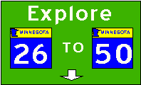
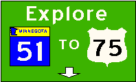
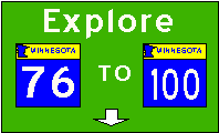
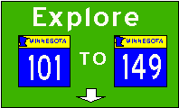
Detailed information on all trunk highways, including all U.S. routes (since 1926) that have ever been posted in Minnesota, and all post-1933 state route numbers (until that time, the marked and legislative route numbers were generally the same). Explore each route's beginning, end, legislative route number, authorization date, information on improvements and anything else I can think of that makes it distinctive.
|
|
|
|
|
|
|
|
|
|
|
Great River Road |
Lots of different types of links. A Map of Minnesota (the number one search phrase), Minnesota tourism, construction information, and other highway pages, as well as important information on how to make an aluminum foil beanie to repel those psychotronic signals. Take a look.
Sources of Information
I have relied heavily on my personal collection of road maps, both from Minnesota and other states (usually with U.S. maps on the back). These include the following:
I also reviewed Official Minnesota Highway Maps at the Borchert Map Library at the University of Minnesota Wilson Library. Maps reviewed included 1927, 1931, 1934, and 1937. Maps at MnDOT Library dated 1923, 1927, 1933, 1935 and 1940 were also reviewed.
Graphics
Most graphics are strictly home-made (unless noted otherwise) using Visio and converting to JPEG format. Or, some files are saved from Visio as .TIF format and converted using MicroGrafx Photo Magic to a .GIF file. I initially used the FHwA look-alike font, Blue Highways, once available free from Larabie Graphics on my sign GIFs. However, I lost this file and found that Larabie now charges for the full set font. Subsequently, I downloaded the Roadgeek 2000 series offered at http://www.triskele.com. I actually like this new font a little better. Old-style sign fonts are courtesy of Bruce Cridlebaugh, who developed this font and offers it for the princely sum of $5. Ron Wilbanks sent me images from the Minnesota Manual of Uniform Traffic Markings from 1929, 1939, 1953 and 1963. Some of those are included on the route markings page and used as background for older signs.
Acknowledgements
Both Andrew Field and Matthew Salek have given me encouragement and suggestions. Adam Froehlig has provided me quite a bit of information from his own research on the history of and upcoming planning for the Twin Cities freeway system. In fact, Adam has provided more information than I can acknowledge. Monte Castleman has also helped, especially with updates of information. Thanks, Ron Wilbanks, for the authentic old route marking sign graphics. I also should acknowledge the others who have developed similar pages and given me ideas and inspiration.
Comments please!!
Please send me your comments. Now that I no longer live in Minnesota, I need reports on highway openings, renamings, plans, etc. Photos also welcome, and will be posted with appropriate credit. My new e-mail address for road-related matters now is <>
Who's Visiting
Millions have visited before July 11, 1998, when I started tracking. Check here for statistics since that time. Extreme Tracking went on-line July 17, 1998. Over 10,000 hits in the first year! Only half the usual volume since moving an abbreviated site to AOL, but now that the whole site is back up, I expect this volume to slowly increase again to previous levels.
| Originally uploaded December 19, 1997 onto Frontiernet | Moved to AOL March 31, 2002 |
| New steve-riner.com site established January 12 2003 | Last updated February 5, 2005 |