|
|
|
|
| Constitutional Routes (yellow star) | CONSTITUTIONAL ROUTE DESCRIPTIONS are taken from the text of the 1920 Babcock Amendment to the Minnesota Constitution, now codified at Minnesota Statutes §161.114. One note regarding route descriptions is that the legal descriptions of many east-west routes run from east to west , while consistent with standard mileposts, all route descriptions on this page go from west to east and south to north . | |||||||||
 | CONSTITUTIONAL ROUTE Posted 1920-33 Beginning at a point on Route No. 10 at Benson and thence extending in a westerly direction to a point on Route No. 6 near Ortonville, affording Benson, Ortonville and intervening and adjacent communities a reasonable means of communication, each with the other and other places within the state. 1927-33 U.S. Highways: 12 1934 designations: U.S. 12 Present-day designations: U.S. 12 Comment: No connection to post-1934 MN-26 | | ORIGINAL 1934 NUMBERING PLAN West Terminus: MN-22 at Glencoe East Terminus: U.S. 212 at Chanhassen Constitutional/Legislative Route(s): 121 Final 1934 Designation: MN-5 Current Designation: MN-5 Comment: This route was defined by these endpoints because of the original plan to route U.S. 212 across the south side of Minneapolis and up West 7th St. to downtown St. Paul. What was odd about that routing was that 212 would have gone to the junction with U.S. 169 north of Shakopee as it did later, but was then routed up what became MN-101, the winding road up the bluff, to Chanhassen, and then from there east to St. Paul. I'm not aware of a reason why 212 wasn't proposed to be routed along this route from Norwood, and then continue on to St. Paul. In the final numbering, MN-5 took over the entire route to St. Paul. As far as the number change, there was no mandatory reason to renumber it. It was given the TH-5 designation that becamse available when 55 was designated, and the 26 designation was given to original TH-73 in far southeast Minnesota. | |||||||
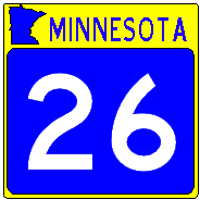
| South terminus: Iowa State Line (IA-26) at Albin North terminus: MN-16 S of La Crescent Length: 21 Region: SE Counties: Houston Legislative Route(s): 198 How numbered: Arbitrary assignment History: Authorized 1933. Improvements: Completely paved by 1953. Comments: Part of Great River Road coming north from Iowa. A beautiful drive. In the original 1934 numbering plan, 26 was intended for part of TH-5, raising the question of what this route was proposed to be. This route was originally planned to be 73, but in the 1934 numbering, that number was used for what became U.S. 59 a year later. | |||||||||
 | CONSTITUTIONAL ROUTE Posted 1920-33 Beginning at a point on Route No. 3 at St. Cloud and thence extending in a northerly direction to a point on Route No. 2 at Brainerd, affording St. Cloud, Sauk Rapids, Royalton, Little Falls, Brainerd and intervening and adjacent communities a reasonable means of communication, each with the other and other places within the state. 1927-33 U.S. Highways: 10N, 371 (by 1932) 1934 designations: U.S. 10, U.S. 371 Present-day designations: U.S. 10, MN-371 including MN-371 Business through Brainerd Comment: Even though it crosses MN-27 at Little Falls, it is unlikely that this route influenced the designation of post-1934 MN-27. | |||||||||
|
| West terminus: MN-28 at Browns Valley East terminus: I-35 at Moose Lake Length: 261 Regions: WC, EC Counties: Traverse, Grant, Douglas, Todd, Morrison, Mille Lacs, Kanabec, Aitkin, Carlton Constitutional/Legislative Route(s): 190, 10, 205, 3, 135, 28, 71, 1 How numbered: Arbitrary assignment, or possibly based on adjacent Constitutional Route 27 (U.S. 10 through Little Falls)
Several Constitutional Route segments, others authorized 1933. The segment between Little Falls and Onamia (L.R. 71) was actually originally authorized as the first legislative route in 1923, running from Little Falls to Milaca. This route would have run along Constitutional Route 18 (current U.S. 169) between Onamia and Milaca, but a court found that for this reason the law authorizing the route was unconstitutional. L.R. 71 was authorized again in 1933, except that it runs from Little Falls to Moose Lake. Original route between MN-47 and MN-65 was over what is now MN-18; original designation of current MN-27 between these routes was MN-66. Easternmost segment of TH-27 is old U.S. 61 through Moose Lake. Improvements: The section southwest of Lake Mille Lacs was still dirt in 1940. The segments east of Isle were gravel into the 50s, and the last segment east of MN-65 was not paved until the 70s. Comments: Concurrent with MN-65 for 23 miles, perhaps the longest state highway route number overlay in Minnesota. | |||||||||
 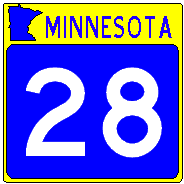 |
West terminus: SD State Line (SD-10) at Browns Valley East terminus: MN-27 W of Little Falls Length: 125 Region: WC Counties: Traverse, Big Stone, Stevens, Pope, Stearns, Todd, Morrison Constitutional/Legislative Route(s): 28 How numbered: Same as Constitutional Route designation History: Constitutional Route over its entire length Improvements: Entire route was paved by 1940. | |||||||||
|
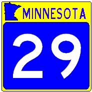 |
South terminus: U.S. 212 at Montevideo North terminus: U.S. 10 at Wadena Length: 125 Region: WC Counties: Chippewa, Swift, Pope, Douglas, Otter Tail, Wadena Constitutional/Legislative Route(s): 38, 29 How numbered: Part of route is Constitutional Route 29; remainder numbered for route continuity. History: Entire route Constitutional Route..In the original 1934 numbering plan, 29 would have extended all the way south along present-day U.S. 59 and MN-23 to U.S. 16. That became MN-73 and MN-39 instead. Improvements: Most of the route was paved by 1940. | |||||||||
 | CONSTITUTIONAL ROUTE Posted 1920-33 Beginning at a point on Route No. 3 at Fergus Falls, and thence extending in a northerly direction to a point on Route No. 8 at Erskine, affording Fergus Falls, Pelican Rapids, Detroit, Mahnomen, Erskine and intervening and adjacent communities a reasonable means of communication, each with the other and other places within the state. 1927-33 U.S. Highways: None 1934 designations: MN-73 (Became U.S. 59 in 1935) Present-day designations: U.S. 59 Comment: No connection to post-1934 MN-30 | | ORIGINAL 1934 NUMBERING PLAN South Terminus: U.S. 10 [52] at Fergus Falls North Terminus: North Dakota border at St. Vincent Constitutional/Legislative Route(s): 30, 174 Final 1934 Designation: MN-73 (Became U.S. 59 in 1935) Current Designation: U.S. 59, MN-175, MN-171 Comment: This numbering proposal continued the use of MN-30 along Constutional Route 30, but extended it further along new legislative routes north and west to the North Dakota border. The entire route was redesignated as part of MN-73 in the final 1934 numbering. That number was likely used in anticipation of an extension or new alignment for U.S. 73 from the south, but that projected route became U.S. 59 instead. The number 30 was instead used on originally proposed MN-77. | 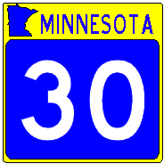
| West terminus: SD State Line (SD-34) W of Pipestone Previously --- MN-15 south of Madelia (1934-63) East terminus: MN-43 at Rushford Length: 253 Regions: SW, SE Counties: Pipestone, Murray, Cottonwood, Watonwan, Blue Earth, Waseca, Steele, Dodge, Olmsted, Fillmore Constitutional/Legislative Route(s): 89, 47, 92, 82, 41, 77 How numbered: Arbitrary assignment.
Two separate Constitutional Route segments: between MN-23 and MN-4, and between U.S. 218 and MN-56. Other segments authorized 1933. Originally designated as MN-47 from SD State Line to MN-4. Renumbered in 1963. In the original 1934 numbering plan, it was intended to be MN-77 east of MN-15. Possibly, that was changed because U.S. 77 was extended into the state along U.S. 12. Improvements: In 1940, only the western segment was paved. In the 1950s, the central portions were still gravel. Paved in its entirety by 1963. | |||||
|
|
West terminus: ND State Line Previously --- U.S. 75 near Hendrum (1934-50) East terminus: U.S. 371 at Walker Previously --- MN-92 at Zerkel (1934-63) Counties: Norman, Mahnomen, Clearwater, Hubbard, Cass Constitutional/Legislative Route(s): 176, 6, 31, 168, 138 How numbered: Part of route was Constitutional Route 31; remainder numbered for continuity
In 1934, T.H. 31 began at what was then U.S. 75 at Ada. In early 1950s, it was extended west over former U.S. 75 and T.H. 116 to North Dakota border, and east over former T.H. 85, later T.H. 92, to Walker. In 1969, renumbered MN-200. | |||||||||
|
|
South terminus: MN-34 S of Rollag North terminus: MN-11 at Greenbush Length: 146 Region: WC, NW Counties: Clay, Norman, Polk, Red Lake, Pennington, Marshall, Roseau Constitutional/Legislative Route(s): 177, 32 How numbered: Part of route is Constitutional Route 32; remainder numbered for route continuity. History: Northern segment Constitutional Route; southern segment authorized 1933. Improvements: In 1940, the route was mostly gravel north of U.S. 2. By 1953, only southernmost five miles were gravel. | |||||||||
 | CONSTITUTIONAL ROUTE Posted 1920-33 Beginning at a point on Route No. 32 at Thief River Falls and thence extending in a northwesterly direction to a point on Route No. 6 at Warren, affording Thief River Falls, Warren and intervening and adjacent communities a reasonable means of communication, each with the other and other places within the state. 1927-33 U.S. Highways: None 1934 designations: MN-1 Present-day designations: MN-1 Comment: Like many of the Constitutional Route descriptions, the direction of travel of the route is inaccurate. Warren is pretty much west of Thief River Falls, not much northwest at all. No connection to post-1934 MN-33 | |||||||||
|
| South terminus: I-35 at Cloquet North terminus: U.S. 53 at Independence Length: 19 Region: NE Counties: Carlton, St. Louis Legislative Route(s): 164 (also incorporates 55) How numbered: Arbitrary assignment. History: Authorized 1933. Original route ran southwest from Cloquet parallel to U.S. 61, and intersected 61 south of U.S. 210. By 1953, the route ran along its current alignment. Improvements: Mostly paved except the original routing south of 210 by 1940. Now mostly expressway (except for portion through Cloquet) with a 65 mph limit. Comments: Major connecting route between I-35 and U.S. 53 toward the Iron Range. | |||||||||
|
|
West terminus: I-94 at Barnesville East terminus: MN-371 at Walker Previously --- U.S. 2 W of Floodwood (1934-69) Length: 103 Regions: WC, NW Counties: Becker, Hubbard, Cass Constitutional/Legislative Route(s): 182, 34 How numbered: Part of route is Constitutional Route 34; remainder numbered for route continuity.
Constitutional Route east of U.S. 10; west segment authorized 1933. Portion east of MN-371 redesignated MN-200 around 1969. Improvements: In 1940, this westerly segment was unpaved. East of U.S. 10, ran along the current alignment of MN-225 through Ponsford until about 1942. By 1953, all but the west segment was paved. | |||||||||
|
|
See MN-135 for details. Renumbered in late 1950s to avoid duplication with I-35 | |||||||||
|
| South terminus (MN): Iowa State Line (I-35) S of Albert Lea Nationally --- U.S. 83 just north of Mexican border at Laredo TX North terminus: MN-61 in Duluth Length (MN): 220 not including mileage on I-35W or 35E Regions: SE, M, EC, NE Counties: Freeborn, Steele, Rice, Scott, Dakota, Anoka, Washington, Chisago, Pine, Carlton, St. Louis Legislative Route(s): 390, 395, 396 How numbered: Interstate Highway
Authorized as part of primary interstate network in the mid-50s. The segment from northeast of downtown Duluth was authorized using interstate substitution money. Improvements: The first segment to open (the first interstate highway opened in Minnesota) was about 10 miles north of Owatonna west of existing MN-218. By 1961, the segment around Hinckley and Sandstone was under construction. Last segment around downtown Duluth completed in the early 90s. Three lanes each way between I-35W/35E north to U.S. 8, and on Thompson hill entering Duluth. Tunnels through downtown Duluth and under Leif Erickson Park. Travelogue: Entering Minnesota from Iowa, you are situated about halfway between U.S. 69 and 65. Through much of your travels through Iowa you have been closer to U.S. 69, but swung east south of Mason City. These routes converge at Albert Lea. Upon entering the state, you will find relief from the flat farmland that characterizes Iowa north of Des Moines. This part of Minnesota has much more in the way of rolling terrain. You will pass I-90 at Albert Lea (destination cities are Sioux Falls and LaCrosse, both in the adjoining states). Major cities along this segment are Owatonna and Faribault, neither of which at this point are exurbs of the Twin Cities. The Twin Cities housing boom starts around the Scott County line south of Lakeville. At Lakeville, the highway splits into I-35W and I-35E (signed for Minneapolis and St. Paul, respectively). Look for a travelogue summary for these routes as well; this narrative continues north of the Twin Cities. I-35W and I-35E join again at Forest Lake. This area is still part of the extended metropolitan area. You will observe that, in contrast to the rolling terrain south of the metropolitan area, this region is quite flat. This is the Anoka Sand Plain, an area that was formed by outwash under the last glaciers that lay over this area as they melted. This is an extensive region that continues north for another 20 miles or so. Instead of the extensive farmland south of the Twin Cities, you have pretty much exited the corn belt for land that better supports grass and alfalfa. At North Branch, you have mostly escaped the urban sprawl though there are still some housing developments catering to commuters. Pass Pine City, and at Hinckley you can visit a museum commemorating a forest fire that burned through this area in the 1890s. Between Sandstone and Moose Lake, the landscape makes a dramatic change. You start to see exposed granite at the surface, and the deciduous forest changes to evergreens. This area is underlain by the Canadian Shield. Climb a steep hill approaching Duluth, then top the hill and look down on the city and Lake Superior. You then slow for Duluth, with numerous exits. The freeway passes the exit for I-535 to Superior, Wisconsin, then dives underground. You pass through several tunnels beneath a park along the Duluth shoreline. Then, I-35 bends left and deposits you on MN-61, London Road, which takes you northeast along the Lake Superior north shore. Comments: Generally constructed along former routes of U.S. 65 south of Twin Cities and U.S. 61 north of Twin Cities. Divides at Twin Cities into I-35W and I-35E. Legislative route designation and mileposts follow I-35E. U.S. 61 parallels both I-35E and I-35 from St. Paul to Wyoming, just north of Forest Lake, but has been decommissioned from Wyoming north. The original plan for construction through Duluth was to build along the lakeshore and connect with the U.S. 61 expressway. That plan was scrapped east of 26th Avenue, but the new design actually rescued the downtown Duluth lakeshore because decaying commercial structures were demolished for highway construction and the surrounding area renovated. | |||||||||
|
| South terminus: I-35 in Burnsville North terminus: I-35 in Forest Lake Length: 39 Region: M Counties: Dakota, Hennepin, Ramsey, Anoka Legislative Route(s): 394 How numbered: "West" branch of I-35
For more details on history see I-35 Special Commentary. While the new St. Anthony Falls Bridge is now open, the collapse of the I-35W Mississippi River crossing in downtown Minneapolis will be a subject of discussion and controversy for years. On August 1, 2007, the 40 year old Mississippi River bridge on I-35W collapsed just after 6:00 p.m. A large number of vehicles (50-100) went down with the bridge, with some landing in the river and others being destroyed as the pavement buckled. The final death toll was 13. Still, given the number of people on the bridge at the time, the death toll could have been far worse. Fortunately, for many drivers, the center part of the river span fell more or less intact straight down, the speed of the fall may have been cushioned slightly by the collapse of the structure under the bridge, and because there was construction on the bridge at the time, traffic was moving very slowly. Furthermore, the river was low due to drought, which gave some people an opportunity to escape from their vehicles in the water. The bridge was a steel deck truss design - all the infrastructure was underneath, and the truss itself was about 20 feet deep. This design is one which is subject to total failure if any major structural component is lost. There were three truss spans, one over each shore adjoining the river and one long span, 458 feet long, over the river itself. Steel beam approach spans over the shores connected to the truss spans on both sides. A security camera at the lock and dam on the south side of the river next to the bridge captured the collapse. It was evident that the river span began to fall from the southwest side of the bridge, and the connection to the pier on the opposite shoreline was immediately severed, bringing the river span down almost all at once. The span on the northeast shore stood for about seven seconds, and then, with the tension that had held it severed, fell backwards. Pieces of the approach spans fell as well. The video suggests, and subsequent investigation seems to bear out, that the collapse began on the downstream side of the southwest side of the bridge - the structure collapsed in that direction. The National Transportation Safety Board (NTSB) report on the collapse blamed underdesigned gusset plates (the metal plates that fasten the truss members together) which were 1/2 inch thick instead of the 1-inch thickness that the design criteria of the day would have required. The initiating event may have been the construction on top of the bridge, which had resulted in heavy equipment and materials being concentrated in small areas. A 2003 photograph taken by MnDOT's bridge consultant clearly shows a bent gusset in the area thought to be the failure point. Strangely, this gusset was not documented on any of MnDOT's otherwise thorough bridge inspection reports. Work on the replacement span began in November 2007 after a contentious bid award process, and the contract was awarded to Flatiron Contractors of Colorado. They began work on a concrete bridge, consisting of all new bridge piers with a span constructed of cast on site concrete box girder sections that were lifted into place with a crane and secured with cables. The final section in the middle was cast in place. This new span opened September 18, 2008, less than 10 months after construction began and 13-1/2 months after the original span collapsed. Loss of the bridge resulted in a considerable detour. Traffic was detoured along I-94 east and MN-280 north to the I-35W junction in Roseville. Some temporary modifications were applied to I-94 and MN-280 to help accommodate the additional traffic, such as closing the MN-280 at-grade intersections at Broadway and County Road B to eliminate the use of the traffic lights there. (These intersections remain closed after the new bridge has been opened, and MnDOT indicates that if they reopen it will be Spring 2009 at the earliest - leading some to speculate that the closures may become permanent to enhance flow on 280.) Improvements: First segment completed was from Burnsville through Bloomington to the current Lyndale Avenue connector in south Minneapolis, completed around 1959 (a segment of freeway or expressway possibly planned for U.S. 65 prior to development of the interstate system). Last segment byukt was through northeast Minneapolis, completed around 1977. Two lanes from the split with I-35 northward, shortly thereafter widens to three lanes at Burnsville Pkwy. (much of this segment has one lane as a HOV lane) from I-35 to 66th St. The number and alignment of lanes through this area north of here will change until around 2010 because of the extensive reconstruction project through the "Crosstown Commons" - the junction and concurrent routing of I-35W and MN-62. North of 46th Street, there are four lanes to the downtown interchange, and two lanes continue from that point. Three lanes after Hiawatha Avenue onramp to the MN-36 split before MN-280, and from the MN-280 junction to the southerly U.S. 10 junction. Four lanes from there to U.S. 10 westbound, three to Lake Drive and two from there north. At the junction with I-35E to form I-35, narrows to one lane. The biggest bottleneck was the "Crosstown Commons", the common section with MN-62. This was supposed to be reconstructed beginning in 2001, but controversy over the design held this project back. MnDOT went back to the drawing board in 2002, finally obtained needed approvals in 2005, but when the project was let in 2006 no one submitted a bid. Something about not being paid for a year or more (part of Governor Pawlenty's "creative financing" program.) As of Spring 2007, project finally began. As of November 2010, the construction is essentially complete, and the two freeways now run totally separate; no more commons. A HOV lane is being extended through the interchange as far north as 46th Street, where the freeway currently widens to four lanes. Travelogue: Leaving I-35 at Burnsville, the highway first climbs a little, then gains a HOV lane and drops steeply toward the Minnesota River. You then climb out of that valley through Bloomington, pass I-494, slow for the urban speed limit (55 as of this writing, maybe to be 60), and approach the formerly dreaded Crosstown Commons. No more commons, though! The two rreeways run parallel but separately, 14 lanes wide in all. A full purpose fourth lane begins from the HOV/HOT lane at 46th Street. At downtown, the left three lanes continue straight ahead into downtown or a ramp to I-94 west, while the right two lanes (the second lane splits) bend sharply east and parallel I-94 for a short time. Now you have an opportunity to cross the new St. Anthony Falls Bridge - observe the wavy sculptures in the middle of the highway at the beginning and end of the segment that goes over the river. After crossing the bridge, there is another bend left and then right through an area at the Johnson Street and New Brighton Blvd. exits that was originally designed to accommodate an interchange with I-335. With the cancellation of that route, we are left with an oddly designed set of bridges and ramps. 35W straightens out as it heads east, then an early ramp for MN-36 splits off to the right but parallels 35W. These parallel lanes cross over the incoming MN-280 ramp, briefly rejoin 35W to allow incoming 280 traffic the opportunity to choose 35W or 36, then split straight ahead while 35W bends sharply left as it turns north. You are now in a mixed industrial and residential area between Roseville and New Brighton. The posted speed rises to 65 mph as you pass several main highways in quick succession: I-694, U.S. 10 east (no direct ramp from NB 35W) and U.S. 10 west. At this point 35W is posted 70 mph as you pass through the expanding northern suburbs of Mounds View and Lino Lakes. The highway bends northeast for several miles, and farmland is again visible. At this point, intersect I-35E (no access from NB) and begin again as I-35. Comments: West leg of I-35 through Twin Cities. North of Minneapolis, closely follows former route of U.S. 8. It is significant that the Twin Cities and Dallas-Ft. Worth --- both on I-35 --- are the only remaining locations where an interstate route has alternate legs with a directional suffix appended to the number. While AASHTO has decreed this practice is no longer acceptable, nearly all the other instances of numbering interstates this way across the U.S. were spur routes that did not return to the parent route, rather than alternate legs. The alternative would be to number one of the branches I-235, but since even prefixes indicate a loop through or around a city while the main route goes around or through, this would not be an accurate numbering method either. One branch could be I-33 or I-37 also, but that wouldn't communicate the fact that the routes rejoin. In the limited cases like this, -W and -E suffixes are the best way of communicating the direction of these routes. Exit Lists: Visit Adam Froehlig's exit lists for I-35W: | |||||||||
|
| South terminus: I-35 in Burnsville North terminus: I-35 in Forest Lake Length: 41 Region: M Counties: Dakota, Ramsey, Anoka Legislative Route(s): 390 How numbered: "East" branch of I-35 History: See I-35 Improvements: First segment completed was north of downtown St. Paul, around 1961. Last segment was the segment south of I-494, around 1985. Three lanes, with several auxiliary lanes, from I-35 to MN-110. Counterintuitively, two lanes from there along the "parkway" segment to downtown St. Paul, except that between MN-13 and Shepard Road, there is a third, auxiliary lane on the Mississippi River bridge. There are also three lanes from I-94 to I-694. Comments: East leg of I-35 through Twin Cities. The segment from W. 7th St. (MN-5) to I-94 in downtown St. Paul was the subject of protracted litigation between area residents and MnDOT. MnDOT finally won the right to construct the freeway after a 15 year battle, but the settlement resulted in construction of a "parkway" section with a truck prohibition and 45 mph speed limit. Actually, this is no New York-style parkway; rather, it's a four-lane freeway with an unrealistically low speed limit, ostensibly to control noise, and a nice planter in the median. This route has the continuation of mileposts and exit numbers from I-35, and also has the same LR number. So, were the directional suffixes to be eliminated, this would be the more likely candidate to carry I-35 through the Twin Cities. Travelogue: Leaving I-35, I-35E angles northeast toward St. Paul. The speed limit through this area continues to be 70 mph on the three lane (each way) freeway as you approach I-494 through Eagan. I-494 east is an important junction for through trucks, since the freeway ahead is restricted; it also provides a bypass for northbound traffic that wishes to avoid the core of the metro area. Past 494, the speed limit drops (as of this writing) to 55, one of the more abrupt slowdowns in the Twin Cities area. You also begin to shed lanes. The highway drops down into the Mississippi River valley, crosses the river on a newly widened bridge, and enters St. Paul. North of W. 7th Street, trucks are prohibited and the speed limit drops to a paltry 45 mph. This is the "parkway" section of I-35E that is the result of a settlement of a long-fought lawsuit. The highway is only two lanes, has a reduced speed limit and a prohibition on trucks. Note the nicely designed overpasses with ornate grillwork and lighting. At downtown St. Paul, you briefly join I-94 eastbound, then angle due north again. From here, it's standard freeway with trucks and a 55 mph limit. North of St. Paul, you intersect I-694, and 35E traffic must travel for about 1.5 miles with that other route. Speed limit in this area is 60 mph. This section was recently improved with the "unweave the weave" project, which eliminated the need for through traffic on each route to cross the flow from the other route to continue. North of 694, the speed limit kicks up to 70 mph and you leave the densely settled urban core for an area with farmland interspersed with new housing developments. A few miles more and you intersect I-35W (no NB access) and rejoin I-35. Future Construction: A major project is widening the highway between I-94 and Maryland Avenue, including a new interchange with Phalen Blvd., programmed for 2010. Exit Lists: Visit Adam Froehlig's exit lists for I-35E: | |||||||||
 | CONSTITUTIONAL ROUTE Posted 1920-33 Beginning at a point on Route No. 3 at Fergus Falls and thence extending in an easterly direction to a point on Route No. 29 easterly of Henning, affording Fergus Falls, Henning and intervening and adjacent communities a reasonable means of communication, each with the other and other places within the state. 1927-33 U.S. Highways: None 1934 designations: MN-3 Present-day designations: MN-210 Comment: No connection to post-1934 MN-36 | |||||||||
| West terminus: I-35W in Roseville Previously (south) --- MN-5 (1934-57); MN-13 (1957-82)* East terminus: Wisconsin State Line (WI-64) at Stillwater Previously --- MN-212 (1934-83) *This segment redesignated as MN-77 around 1980. At that time, the Cedar Ave. segment between CSAH 62 and downtown Minneapolis was redesignated, part as unnumbered state route and part as city street. Length: 17 Region: M Counties: Ramsey, Washington Constitutional/Legislative Route(s): 118, 45, 339 How numbered: Arbitrary assignment NHS: Entire length
For history of original route south of MN-62, see MN-77. Authorized 1933 except for portion that formerly ran south of MN-5. Originally ran from Stillwater west to downtown Minneapolis via County Roads C and B (replaced by a divided highway on the current freeway alignment by the early 1940s), connecting to Broadway and Johnson Street. South of downtown Minneapolis, ran along Cedar Avenue. I believe the corresponding legislative route was 118, which then turned west along 46th St. as TH-90, until LR 279 was authorized in 1949; the segment between 46th St. and TH-5 (78th St.) was not part of the trunk highway system until that year, though it was marked as TH-36 from 1934 (as an "accommodation route"). Original terminus was at MN-5 until the mid 1950s, and then the route was extended south across the Minnesota River to MN-13. The section of old MN-36 south of MN-62 is now designated MN-77, remainder (Cedar Ave. through Minneapolis) is CSAH 152. On east end, formerly terminated at MN-212 (now MN-5), with remainder of route to Wisconsin border designated MN-212 until around 1983. Improvements: Paved by 1940, with divided highway segment between Cleveland Avenue and U.S. 61. Now freeway from I-35W to east of U.S. 61, remainder of route is divided highway to just south of Stillwater (for about 4 miles between CSAH 36 and CSAH 15, posted 65 mph). Future Improvements: [Review of MnDOT docs needed to update this] Comments: Originally was intended to run along a Cedar Avenue Freeway from downtown. Only the part south of MN-62, currently designated MN-77, was built. On the east end, controversy over the proposed replacement St. Croix River crossing delayed this project, a four-lane bridge across the river south of Stillwater, to be stalled for years. Part of the problem was that the St. Croix River is a National Wild and Scenic River in this stretch. The saga began in the 1970s, but finally in 2018, a beautiful new span with freeway connections on both sides opened. Exit list: Visit Adam Froehlig's exit list for Highway 36 | |||||||||
 | CONSTITUTIONAL ROUTE Posted 1920-33 Beginning at a point on Route No. 27 at Little Falls and thence extending in a northwesterly direction to a point on Route No. 2 at Motley, affording Little Falls, Motley and intervening and adjacent communities a reasonable means of communication, each with the other and other places within the state. 1927-33 U.S. Highways: U.S. 10N 1934 designations: U.S. 10 Present-day designations: U.S. 10 Comment: No connection to post-1934 MN-37 | |||||||||
| West terminus: U.S. 169 at Hibbing Previously --- U.S. 53 near Virginia (1934-63) East terminus: MN-135 at Gilbert Length: 27 Region: NE Counties: St. Louis Legislative Route(s): 216, 202 How numbered: Arbitrary assignment, or maybe because it is close to 35 (the former designation for MN-135).
East of U.S. 53, authorized 1933. Between Hibbing and Eveleth, authorized around 1950. Segment between U.S. 169 at Hibbing and U.S. 53 originally designated MN-216, like the LR for that segment, until 1963. Improvements: Paved by 1940. No significant divided segments. | |||||||||
 | CONSTITUTIONAL ROUTE Posted 1920-33 Beginning at a point on Route No. 12 at Montevideo and thence extending in a northerly direction to a point on Route No. 28 at Starbuck, affording Montevideo, Benson, Starbuck and intervening and adjacent communities a reasonable means of communication, each with the other and other places within the state. 1927-33 U.S. Highways: none 1934 designations: MN-29 Present-day designations: MN-29 Comment: No connection to post-1934 MN-38 | |||||||||
|
| South terminus: U.S. 2 at Grand Rapids North terminus: MN-1 at Effie Length: 47 Region: NE Counties: Itasca Legislative Route(s): 196 How numbered: Arbitrary assignment History: Authorized 1933. Improvements: Paved by 1940. Comments: A very scenic (if twisty) road extending north from Grand Rapids that is a National Scenic Byway. | |||||||||
 | CONSTITUTIONAL ROUTE Posted 1920-33 Beginning at a point on Route No. 7 at Mankato and thence extending in a southeasterly direction to a point on Route No. 9 westerly of Albert Lea, affording Mankato, Mapleton, Minnesota Lake, Wells and intervening and adjacent communities a reasonable means of communication, each with the other and other places within the state. 1927-33 U.S. Highways: none 1934 designations: MN-109, MN-22 Present-day designations: MN-109, MN-22 Comment: No connection to post-1934 MN-39 | |||||||||
| | ORIGINAL 1934 NUMBERING PLAN South Terminus: U.S. 75 at Madison North Terminus: MN-5 [55] and MN-27 W of Hoffman Legislative Route(s): 144 Final 1934 Designation: MN-119, MN-73 Current Designation: MN-119, U.S. 59 Comment: Part of this route became MN-73 in the final numbering, but the remainder was given the MN-119 designation that had been used for what became MN-152. The renumbering of that part doesn't appear to have been mandatory. MN-39 was used instead further south on part of the originally proposed southern extension of MN-29, now part of MN-23. |
| South terminus: U.S. 16 at Beaver Creek North terminus: U.S. 59 at Marshall Legislative Route(s): 88 How numbered: Arbitrary designation
Route designated in 1933, combined (along with original T.H. 17) around 1940 with T.H. 23. | |||||||
| West terminus: MN-23 S of Duluth Previously --- U.S. 61 at Carlton (1950-72) on west (original terminus was where it is today) East terminus: Wisconsin State Line (WI-105) W of Superior Length: 1 Region: NE Counties: St. Louis Legislative Route(s): 213 How numbered: Arbitrary assignment
Authorized around 1947. Improvements: Apparently paved by the time it became a trunk highway.
| |||||||||
 | CONSTITUTIONAL ROUTE Posted 1920-33 Beginning at a point on the boundary line between the states of Minnesota and Iowa at Lyle and thence extending in a northwesterly direction to a point on Route No. 7 at Owatonna, affording Lyle, Austin, Blooming Prairie, Owatonna and intervening and adjacent communities a reasonable means of communication, each with the other and other places within the state. 1927-33 U.S. Highways: 218 1934 designations: U.S. 218 Present-day designations: U.S. 218 Comment: No connection to post-1934 MN-40 | |||||||||
 | West terminus: SD State Line (SD-20) near Marietta Previously --- U.S. 75 at Madison (1934-49) East terminus: Kandiyohi CSAH 5 (30th St. SW) on the west edge of Willmar (since 2009) Previously --- U.S. 12 at Willmar (1934-2009) Length: 72.72 mi. Region: WC Counties: Lac Qui Parle, Chipewa, Kandiyohi Legislative Route(s): 276, 144, 145 How numbered: Arbitrary assignment History: Authorized 1933, except for portion west of U.S. 75, authorized around 1950. Improvements: All unpaved in 1940. By 1953, mostly paved except for just west of Willmar. All paved by 1958. | |||||||||
 | CONSTITUTIONAL ROUTE Posted 1920-33 Beginning at a point on Route No. 40 at or near Blooming Prairie and thence extending in an easterly direction to a point on Route No. 56, hereinafter described, near Hayfield, affording Blooming Prairie, Hayfield and intervening and adjacent communities a reasonable means of communication, each with the other and other places within the state. 1927-33 U.S. Highways: None 1934 designations: MN-30 Present-day designations: MN-30 Comment: No connection to post-1934 MN-41 | |||||||||
|
| South terminus: U.S. 169 S of Shakopee Previously --- U.S. 212 at Chaska (1934-49) North terminus: MN-7 at Shorewood Length: 11 Region: M Counties: Scott, Carver, Hennepin Constitutional/Legislative Route(s): 260, 12 How numbered: Arbitrary assignment History: North of U.S. 212, part of Constitutional Route 12. South, authorized 1950. Improvements: Original segment paved by 1940. Minnesota River bridge constructed early 1950s. | |||||||||
|
|
South terminus: I-90 near Eyota Previously --- U.S. 14 near Eyota (1934-2002) North terminus: U.S. 61 at Kellogg Length: 28 Region: SE Constitutional/Legislative Route(s): 338, 42 Counties: Olmsted, Wabasha How numbered: Same as its Constitutional Route designation History: Constitutional Route in entirety. There may have been an intention around the time I-90 was constructed (around 1970) to extend this route south to I-90; L.R. 314 would have been this connection, but the extension of this route was apparently never marked, and L.R. 314 was deleted in the mid 1970s. This is surprising, since the length of this connecting segment would have been maybe five miles. And now, as of 2002, the road was extended to I-90. (Why not go all the way to U.S. 52, since that segment of CSAH 7 is also a major connector to I-90 eastbound for U.S. 52 traffic?) Improvements: Paved by 1940, on current alignment by 1953. Comment: The 2001 legislation that authorized extension of this route to I-90 amended the description of Constitutional Route 42 rather than creating a new route for the I-90-U.S. 14 segment. This is the first time the constitutional route descriptions have been legislatively amended. The 2003 Legislature undid this and created L.R. 338 instead. Photo: New south end of MN-42 at I-90 (by Monte Castleman) | |||||||||
  |
South terminus: MN-44 at Mabel North terminus: Wisconsin State Line (WI-54) at Winona Length: 44 Region: SE Constitutional/Legislative Route(s): 78, 43, 75 Counties: Fillmore, Winona How numbered: Part of route is Constitutional Route 43; remainder numbered for route continuity. History: Constitutional Route between Rushford and Winona, other two segments authorized 1933. Improvements: In 1929, was paved from Wilson to Winona. By 1940, only gravel segment was south of Rushford. Entire route paved by 1953. In 1980s, a major project to rebuild the highway from I-90 to Winona as an expressway ran out of money, and only one carriageway was actually paved. There is still visible road bed and bridges east of the roadway in this segment. | |||||||||
|
West terminus: U.S. 52 near Canton Previously --- U.S. 63 south of Spring Valley (1972-95); original west terminus was where it is now East terminus: MN-16 at La Crescent Length: 34 Region: SE Counties: Fillmore, Houston Constitutional/Legislative Route(s): 44 How numbered: Same as its Constitutional Route number History: Current authorized length is Constitutional Route. A westerly segment from U.S. 63 to Harmony (L.R. 331) existed from the 1970s to 1995, but has been turned back to Fillmore County. Same in extent and number as in 1920. Improvements: Paved in total by 1940. | |||||||||
 | CONSTITUTIONAL ROUTE Posted 1920-33 Beginning at a point on the west bank of the St. Croix River at Stillwater and thence extending in a southwesterly direction to a point on the easterly limits of the city of St. Paul, affording Stillwater, Lake Elmo, St. Paul and intervening and adjacent communities a reasonable means of communication, each with the other and other places within the state. 1927-33 U.S. Highways: None 1934 designations: U.S. 212 (became MN-212 in 1935) Present-day designations: MN-5, MN-36 Comment: No connection to post-1934 MN-45 | |||||||||
|
| South terminus: MN-210 at Carlton Previously --- U.S. 61 north of Carlton (1934-68); would have been east end of route North terminus: I-35 E of Cloquet Previously --- MN-33 in Cloquet (1934-95); would have been west end of route Length: 2 Region: NE Counties: Carlton Constitutional/Legislative Route(s): 1 How numbered: Arbitrary assignment
Remaining segment was originally part of U.S. 61, Constitutional Route 1. The route originally designated MN-45 is the extension of this route north of I-35 to Cloquet, which was Constitutional Route 55. This segment was turned back to Carlton County and the City of Cloquet around 1995. Improvements: Paved as early as 1929. Comment: This route does not currently include any of its original marked extent. | |||||||||
 | CONSTITUTIONAL ROUTE Posted 1920-33 Beginning at a point on the west bank of the St. Croix River at Taylors Falls and thence extending in a southwesterly direction to a point on Route No. 1 near Wyoming, affording Taylors Falls, Center City, Wyoming and intervening and adjacent communities a reasonable means of communication, each with the other and other places within the state. 1927-33 U.S. Highways: 8 1934 designations: U.S. 8 Present-day designations: U.S. 8 (see comment) Comment: On the west end, this CR no longer runs on the road for which it was originally designated. That road became MN-98 when the designations of MN-98 (Leg. Rt. 98) and U.S. 8 (CR-46) were flip-flopped in the 1950s. The Legislative/Constitutional route designations were not changed at the time, though. MN-98 was later turned back, Leg. Rt. 98 eliminated and CR-46 moved onto U.S. 8. If Forest Lake is "near Wyoming" then CR-46 can end at U.S. 61 (CR-1). No connection to post-1934 MN-46 | |||||||||
|
| ORIGINAL 1934 NUMBERING PLAN South Terminus: MN-66 [7] at St. Bonifacius North Terminus: U.S. 12 at Maple Plain Constitutional/Legislative Route(s): 120 Final 1934 Designation: MN-110 Current Designation: Hennepin CSAH 110 Comment: This highway ran along the west side of Lake Minnetonka. Its originally proposed number went up north to the southerly extension of MN-72, a change probably made because it was logical to divide 72 there. This was one of the first routes turned back from the trunk highway system. | |||||||||
|
| South terminus: U.S. 2 near Deer River North terminus: U.S. 71 at Northome Length: 47 Region: NE Counties: Itasca, Koochiching Legislative Route(s): 165 How numbered: Arbitrary assignment History: Authorized 1933. In the original 1934 numbering plan, this would have been an extension of MN-72. Improvements: By 1953, there was one remaining gravel segment in the middle of this route. It was totally paved by 1958. Comments: In the original 1934 numbering plan, 46 was intended for use on the route that became TH-110 (west of Lake Minnetonka). | |||||||||
|
|
West terminus: SD State Line (SD 34) west of Pipestone East terminus: MN-4 north of St. James Constitutional/Legislative Route(s): 89, 47, 92 How numbered: Part numbered for its Constitutional Route designation, remainder numbered for continuity.
In 1933, existing T.H. 47 extended west and east along new Legislative Route segments. In 1963, the T.H. 30 designation was extended west along this route. | |||||||||
|
| South terminus: MN-65 in Minneapolis Previously --- U.S. 12/52 (Washington/University Aves) near U of M (1963-85) North terminus: U.S. 169 at Aitkin Length: 125 Region: M, EC Legislative Route(s): 156, 110 How numbered: Arbitrary assignment
Authorized 1933. Southern end formerly extended down University Avenue to Washington (former junction with U.S. 12/52). The entire route was an extension of MN-56 until 1963 when it was redesignated. Improvements: In 1940, nearly all gravel north of Anoka. By 1953, only the northerly segment near Aitkin was unpaved. North of Anoka, the route is all two-lane. The southerly segment through Anoka County was divided by about 1970, and the northerly 1/2 mile of this part is freeway, connecting with U.S. 10. Comments: Eventually, this is likely to be turned back south of U.S. 10. There was a plan (briefly) in the 1960s to construct some interchanges at major intersections between I-694 and U.S. 10. | |||||||||
 | CONSTITUTIONAL ROUTE Posted 1920-33 Beginning at a point on Route No. 17 westerly of Granite Falls and thence extending in a westerly direction to a point on Route No. 6 at Canby, affording Granite Falls, Clarkfield, Canby and intervening and adjacent communities a reasonable means of communication, each with the other and other places within the state. 1927-33 U.S. Highways: none 1934 designations: MN-19 Present-day designations: MN-19 Comment: No connection to post-1934 MN-48 | |||||||||
| West terminus: I-35 at Hinckley East terminus: Wisconsin State Line (WI-77) near St. Croix State Park Length: 25 Region: EC Counties: Pine Legislative Route(s): 192 How numbered: Arbitrary assignment History: Authorized 1933. Improvements: Paved by 1953. Major access to Grand Casino Hinckley and St. Croix State Park. | |||||||||
 | CONSTITUTIONAL ROUTE Posted 1920-33 Beginning at a point on Route No. 12 easterly of Montevideo and thence extending in a northeasterly direction to a point on Route No. 4 southerly of Willmar, affording Montevideo, Clara City, Willmar and intervening and adjacent communities a reasonable means of communication, each with the other and other places within the state. 1927-33 U.S. Highways: 212 1934 designations: MN-40 Present-day designations: MN-40 Comment: The west endpoint for this route changed before 1934. A new alignment for CR-12 bypassing Montevideo to the south and east opened by 1933, and this became the route of U.S. 212 in 1934. The description above is therefore inaccurate in that it references an intersection with CR-12 east of Montevideo. No connection to post-1934 MN-48 | |||||||||
|
| South terminus: MN-5 (W. 7th St.) 1934-50; MN-218 / MN-3 in Inver Grove Heights (1950-81); U.S. 12/52, later unmarked MN-952A(University Ave) 1981-98 North terminus: U.S. 8 (1934-66); Lino Lakes Correctional Facility (1966-97); I-694 in Vadnais Heights (1997-98) Constitutional/Legislative Route(s): (1, 102),126, (326) How numbered: Arbitrary assignment
Authorized 1933, originally only marked north from St. Paul. In 1950, extended over the High Bridge and replaced MN-88 south to T.H. 218 (later T.H. 3). This segment was renumbered T.H. 149 around 1980 to eliminate the route concurrency with U.S. 12-52 and MN-5 which had been created by the 1950 route extension. This restored the original south terminus of MN-49, at Rice St. and University Ave. The north end of the route originally ran north from Vadnais Heights along Hodgson Road (now Ramsey and Anoka CSAH 49) and terminated at Lake Drive, which was originally U.S. 8. However, when I-35W was completed and the U.S. 8 designation moved onto the freeway, MN-49 was extended north along Lake Drive (now designated CSAH 23 in its entirety) to I-35W. At this time, it was consolidated with a state facility service route that extended north and west to the Lino Lakes Correctional Facility (L.R. 326, originally designated MN-326, now CSAH 159). The entire segment north of 694 was turned back in 1997 and the Legislative Route was eliminated in 1998. Final sign changes (indicating that the actual transfer of Rice St. south of I-694 may have been delayed until 2000) seen in summer 2000. | |||||||||
|
|
West terminus: MN-3 at Farmington Previously --- U.S. 65 at Farmington (1934-57); U.S. 65/I-35W at Lakeville (1957-94) East terminus: U.S. 61 E of New Trier Previously --- U.S. 52 at Hampton (1934-49) Length: 15 Region: M Counties: Dakota Constitutional/Legislative Route(s): 50, 245 How numbered: Part of route is Constitutional Route 50; remainder numbered for route continuity.
Legislative Route 245 segment authorized 1950. Segment west of MN-3 to I-35 turned back to Dakota County as CSAH 50 in 1994. West of U.S. 52, this was the original route of U.S. 55, which ran west along the alignment of 50 and north generally along current I-35/35W to Minneapolis. From 1934 until about 1957, U.S. 65 followed this alignment from Farmington. Improvements: The original Constitutional Route portion was paved as early as 1929. The newest segment east of U.S. 52 was unpaved in 1953, paved by 1961. |
Travel on...
| You are at Routes 26-50 | ||
Last updated December 27, 2021