|
|
|
|
| Note: Many of the following routes (288-303 and a few others that follow) are very short connecting routes that were established to service a State facility such as a prison or state hospital from an adjoining trunk highway. Unless otherwise indicated, the legislative and marked route numbers are the same. | |||||
 | South terminus: U.S. 10 North terminus: Anoka State Hospital Counties: Anoka History: Authorized 1951. It was decommissioned in 1998 and turned back to Anoka County as CSAH 7, and in part to the city of Anoka. | ||||
 | South terminus: Minnesota Correctional Facility -Moose Lake (formerly the Moose Lake Treatment Center) North terminus: MN-73 at Moose Lake Length: <1 Region: EC Counties: Carlton History: Authorized 1951 Comment: Rerouted from its original routing to a more direct route farther south | ||||
 | South terminus: Walker Treatment Center North terminus: MN-371 Length: <1 Region: NW Counties: Cass History: Authorized 1951. Removed from route system by 2009 Legislature. Comment: This route was never actually marked. | ||||
 | West terminus: U.S. 61 at Hastings East terminus: Dakota CSAH 54 E of Hastings Veterans Home Length: 1 Region: M Counties: Dakota History: Authorized 1951. Removed 2012, now city street (18th St.) Comment: Originally ran off of 10th Street and into the Veterans Home from the north rather than from the west as in later years. | ||||
 | South terminus: U.S. 61 Thru Red Wing Boys Home North terminus: U.S. 61 Length: <1 Region: SE Counties: Goodhue History: Authorized 1951 | ||||
 | West terminus: MN-95 in Cambridge East terminus: Main St. (old Hwy. 65) in Cambridge near Cambridge State Hospital Length: <1 Region: EC Counties: Isanti History: Authorized 1951 Comment: Removed from state highway system by 2009 Legislature, several years after closure of Cambridge State Hospital. | ||||
 | South terminus: Bus. Rte. U.S. 71 Thru Willmar Regional Treatment Center North terminus: Bus. Rte. U.S. 71 Length: <1 Region: WC History: Authorized 1951. 2006 legislation removed route from trunk highway system. Comments: For many years, one of two trunk highways in Minnesota that do not intersect another trunk highway (Business 71 is a city street) because the original connecting route was turned back. Nevertheless, it was marked from U.S. 71/MN-23 at the interchange with Business 71. | ||||
 | West terminus: St. Peter State Hospital East terminus: U.S. 169 S of St. Peter Counties: Nicollet Length: <1 Region: SE History: Authorized 1951. Removed 2008. | ||||
 | West terminus: U.S. 63 in Rochester East terminus: Rochester State Hospital History: This route formerly served the Rochester State Hospital, which is now a federal prison facility. Authorized 1951, turned back around 1990. Former MN-296 is a Rochester city street | ||||
 | West terminus: W. Fir Ave., Fergus Falls Thru Fergus Falls State Hospital East terminus: W. Fir Ave., Fergus Falls Length: <1 Region: WC Counties: Otter Tail History: Authorized 1951. Removed as a Legislative Route by the 2010 Legislature. Comments: Like 294 before its removal, this route does not intersect any other state trunk highway, but formerly intersected MN-210 before that highway was re-routed south of the city. This route was turned back to the city of Fergus Falls, not to the county as most trunk highways are when removed. | ||||
 | South terminus: Faribault Correctional Facility North terminus: MN-60 in Faribault Length: 0.6 mi. Region: SE Counties: Rice Legislative Route(s): 298 History: Authorized 1951 to serve the series of state institutions (see comments), additional loop around 1970. This added loop, into the Minnesota State Academy for the Blind, was authorized under L.R. 323, and in 2009 was given that number as its trunk highway designation, as a separate route. The south end, which used to loop around and return north to join itself, was terminated at the entrance of the Correctional Facility. Comments: State facility route serving the Minnesota Correctional Facility, formerly the Minnesota Regional Treatment Center. Once upon a time, the Regional Treatment Center was originally called the "State Academy for the Feeble-Minded." | ||||
 | South terminus: MN-60 in Faribault North terminus: State Academy for the Deaf Length: <1 Region: SE Counties: Rice History: Authorized 1951 Comments: Intersects MN-60 at the same place as MN-298. | ||||
 | West terminus: U.S. 169 in Shakopee East terminus: Women's Correctional Facility History: Authorized 1951, formerly ran from old U.S. 169 (now CSAH 69) in Shakopee to the Women’s Correctional Facility. Turned back 1996. Now an extension of Scott CSAH 16. | ||||
 | West terminus: St. Cloud Men’s Reformatory East terminus: U.S. 10 SE side of St. Cloud Length: <1 Region: EC Counties: Sherburne History: Authorized 1951 | ||||
 | West terminus: U.S. 71 East terminus: State Home for Girls, Sauk Centre Length: <1 Region: EC History: Authorized 1951 Comment: Deleted from the trunk highway system in 2003. The property at the Girls Home was sold, and the highway vacated upon sale of the property. Because the property is being redeveloped, the roadway as well as the route have disappeared. | ||||
|
| South terminus: U.S. 14/65 in Owatonna Thru state school North terminus: U.S. 14/65 in Owatonna History: Authorized 1951. Formerly served a state school in northwest Owatonna, forming a loop off then-U.S. 14/65. Turned back 1973. | ||||
 | South terminus: MN-11 W of Roseau North terminus: MN-89 Length: 1 Region: NW Counties: Roseau
Authorized around 1958. Actually was the original alignment of MN-89 north of MN-11 until a shortcut was constructed for that route. Comments: West leg of a "Y" joining MN-89 north to MN-11. | ||||
 | West terminus: MN-18 Thru Brainerd State Hospital East terminus: MN-18 Length: 1 Region: EC Counties: Crow Wing History: Authorized around 1959. Removed 2014. Comment: Not marked. | ||||
 | South terminus: MN-11 at Roseau North terminus: Canadian Border (MB-Sec. 310) S of South Junction MB Length: 10 Region: NW Counties: Roseau Improvements: Paved by 1970 History: Authorized around 1959. Comment: This looks like it ought to be an extension of MN-89, but 89 was extended north of MN-11 to the Canadian border around 1949 via L.R. 218. This route, when authorized, was thus given a separate designation. | ||||
 | West terminus: MN-41 in Chanhassen (last temporary end of freeway before connection to U.S. 212; previously Dell Road and Eden Prairie Road) East terminus : MN-5 in Eden Prairie Length: 10* Region: M Legislative Route(s): 260 Counties: Carver, Hennepin How numbered: Derivative of its future permanent designation, U.S. 212 NHS: Along its entire length Improvements: Only marked on freeway segments of future U.S. 212 as they were completed, never on any temporary connecting routes. History: Part of new U.S. 212 realignment, authorized mid-1970s, first marked on initial freeway segment west of MN-5 around 2001. Renumbered as U.S. 212 when freeway segment was completed in 2008. Comment: Applied as a temporary designation for completed sections of what became U.S. 212 from west of Chaska to the junction with I-494 and MN-5 in Eden Prairie, bypassing the Flying Cloud Drive segment. The route number was never posted on the unmarked short segment of freeway east of I-494 to the Flying Cloud Drive exit where U.S. 212 joined, and from field accounts it was only marked on overhead and freeway onramp signs along the new freeway west of MN-5, never on freestanding reassurance markers. | ||||
 | South terminus: MN-11 at Warroad North terminus: Canadian Border (MB-12) E of Middlebro MB Length: 6 Region: NW Counties: Roseau Improvements: Paved by 1963 History: Authorized around 1959. | ||||
 | South terminus: U.S. 61 W of Red Wing North terminus: U.S. 61 at Hastings Length: 10 Region: SE, M NHS: Its entire length, as the general future alignment of U.S. 61 Counties: Goodhue, Dakota History: Authorized around 1959. Improvements: Paved since it became a trunk highway Comments: Serves as a shortcut along U.S. 61 between Hastings and Red Wing. Narrow shoulders and heavy traffic make it a potentially dangerous road. Future improvements to U.S. 61 will likely be generally along this alignment, and safety improvements (shoulders, turn lanes) have been made. Unfortunately, Hastings' growth appears to be following this route, making significant widening along the current alignment potentially problematic. One plan is to bend this route west to intersect U.S. 61 south of its current intersection with U.S. 61 and connect with an upgraded County 46. | ||||
 | West terminus: ND State Line (ND-17) E of Grafton ND East terminus: MN-220 S of MN-11 Length: 1 Region: NW Counties: Marshall History: Authorized around 1959. Improvements: Paved by 1970 How numbered: Same as its Legislative Route number, not by association with the intersecting North Dakota route. | ||||
 | South terminus: MN-23 at Willmar North terminus: MN-40 at Willmar History: A former short route connecting MN-23 and MN-40 on the west end of Willmar. Authorized late 1960s, turned back after MN-23 bypass opened around 1980. | ||||
| West terminus: (now business rte.) MN-371 East terminus: MN-18 in Brainerd Length: <1 Region: EC History: Authorized around 1959. Removed from trunk highway system in 2001 Comments: This may have been the shortest trunk highway. It wasa one-block long connector between 371 (now Business 371) and the former route of 18 in Brainerd. At either end from its joining routes, it was marked "To 18" and "To 371", but was also signed as 322. This was turned back (along with TH-18 through Brainerd) after the TH-371 bypass was completed in late 2000. | ||||
 | A loop through the Minnesota State Academy for the Blind, from MN-298. Length: 0.2 mi. Region: SE Counties: Rice Legislative Route(s): 323 History: Authorized around 1970 under this LR number, but administratively treated as a loop of MN-298. In 2009 the loop was apparently designated on the books as a separate route and was given its LR number as its trunk highway designation,.(I'm hedging because the logpoint and control section documents still show the separate loop as part of 298). Comments: This is but a driveway into a state institution. See the map if you don't believe me. It may be the shortest trunk highway in the system, and I wonder whether it's posted with its number. Unfortunately, Google Streetview hasn't gone down 298 yet, so I can't tell from that, but if anyone is driving through Faribault please check and let me know! Adam Froehlig found this change while poring over newly updated city and county maps on MnDOT's web site. | ||||
 | West terminus: I-35 at Pine City East terminus: MN-361 at Pine City Constitutional/Legislative Route(s) 1 and 324 History: A one-mile connecting route between I-35 and originally U.S. 61, shortly thereafter MN-361, at Pine City. This was the only route administratively authorized around 1965 by MnDOT under a law authorizing establishment of short connecting routes from Interstate highways at a few specified locations. It was shown on the 1997-98 Minnesota Highway map as being removed from the system, but restored on the 1999-2000 map. Eliminated 2003. | ||||
|
| South terminus: U.S. 8 in LIno Lakes North terminus: Lino Lakes Correctional Facility (this designation approx. 1965-68)
Original designation for LR 326, which ran from Lake Drive (originallyU.S. 8) for 1/2 mile to the Lino Lakes Correctional Facility. When I-35W was completed in the late 1960s, the U.S. 8 designation was moved to the interstate. MN-49, which had ended at Lake Drive south of this point was extended north along Lake Drive to I-35W, and was then also extended onto the prison access route. Since MN-49 was turned back in 1997 north of I-694, LR 326 was removed from the statutes and the road is now designated Anoka CSAH 159. | ||||
 | West terminus: MN-9 at Morris East terminus: Univ. Of Minn., Morris Counties: Stevens Length: 2 Region: SW History: Authorized around 1970 | ||||
 | West terminus: U.S. 14 Thru Univ. of Minn. Experimental Station, Lamberton East terminus: U.S. 14 Length: 2 Region: SW Counties: Redwood History: Authorized around 1975 Comments: Serves a University of Minnesota agricultural experimental station | ||||
 | West terminus: U.S. 71 W of Intl. Falls East terminus: U.S. 53 S of Intl. Falls Former Terminus --- MN-11 E of Intl. Falls Length: 3 Region: NE Counties: Koochiching History: Authorized around 1975. Eastern segment of route from U.S. 53 north to MN-11 removed by 2010 Legislature. Remainder of route removed 2011. Now CSAH 331. Comments: A bypass around the south side of International Falls. | ||||
|
| South terminus: St. Peter State Hospital North terminus: MN-99 W of St. Peter Length: <1 Region: SE Legislative Route(s): 335 History: Authorized around 1983. Removed 2008. How numbered: Here's an odd one. It was apparently numbered different from its Legislative Route number to avoid duplication with proposed I-335, a Twin Cities area freeway that was planned but canceled about 1980, even though this route was created after I-335 was canceled. | ||||
 | South terminus: I-94 (exit 6) E of Moorhead North terminus: U.S. 10 E of Dilworth Length: 2 Region: WC NHS: Its entire length, as a connector between I-94 and U.S. 10 History: Authorized around 1991. Improvements: Always paved as a trunk highway. Widened to 4 lanes and an interchange built at U.S. 10. (So, it now functions as essentially an extended ramp between the two routes). Comments: A short connector between I-94 and U.S. 10 east of Moorhead. | ||||
 | South terminus: I-35 at Rush City North terminus: MN-70 N of Rush City Previously --- MN-324 at Pine City (1967-2003) Length: 7 mi. Constitutional/Legislative Route(s): 1 Counties: Chisago, Pine How numbered: Derivative of its former designation U.S. 61
A section of old U.S. 61 along I-35, maintained as a trunk highway after completion of the interstate apparently to provide continuation of Constitutional Route 1 through Rush City and Pine City. Shown on the 1997-98 Minnesota Highway map as being turned back but is again marked on later official maps. The route was cut back in 2003 from its original terminus in Pine City south to TH-70. In looking at the Control Section Guide, I-35 does cross both the Pine City and Rush City municipal boundaries, so this route is no longer required as described above. It was fully turned back some time in the 2010s. Now Chisago CSAH 30 and Pine CSAH 61. | ||||
See MN-371 below for route history and details. This U.S. route was added in 1931 between Little Falls and Cass Lake. It was also marked along U.S. 2 between Bemidji and Cass Lake. It was redesignated MN-371 around 1973. | |||||
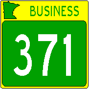 | South terminus: MN-371 south of Brainerd North terminus: MN-371 and 210 at Baxter Length: 5 Region: EC Constitutional/Legislative Route(s): 337 Counties: Crow Wing How numbered: Old MN-371 through Brainerd and west into Baxter
When the Brainerd Bypass opened in August 2000, the old route through Brainerd was redesignated as MN-371 Business. Comments: One of just two bannered business routes in the state that are still trunk highways. Runs concurrent with MN-210 from downtown Brainerd west to the junction with 371 in Baxter. The newest legislative route number. Note the different signage (similar signage is also used on the non-trunk highway Business 23 through Willmar). | ||||
|
| South terminus: U.S. 10 at Little Falls North terminus: U.S. 2 at Cass Lake Previously --- (as U.S. 371) U.S. 71 at Bemidji (until about 1973) Length: 110 Region: EC, NE Constitutional/Legislative Route(s): 27, 19 Counties: Morrison, Crow Wing, Cass How numbered: Formerly designated as U.S. 371 NHS: Along its entire length
Constitutional Route its entire length. U.S. 371 was first designated around 1931, redesignated as state-numbered route around 1973. Improvements: Freeway from Little Falls to Morrison CSAH 48. Expressway north of there, including the bypass west of Brainerd that opened in 2000 (also called the "C. Elmer Andersen Brainerd Bypass" after the former mayor and Minnesota governor), to about five miles north of Baxter. From that point north, mostly two lanes. Future Improvements: The "Paul Bunyan Expressway" is ultimately planned as a four lane expressway along much of its length, since it is a major connecting route between the Twin Cities and central Minnesota resorts. Programmed improvements from Nisswa to Pine River have been pushed back to 2018. Comments: As I indicated at the description of MN-15, these two routes could be linked together to form a single marked route from the Iowa border to Cass Lake. I would use the MN-15 designation and not seek a U.S. route designation, since route 15 doesn't connect to anything significant in Iowa and the old U.S. 371 designation has already been reused in Arkansas and Louisiana. This would entail a 27 mile overlay on U.S. 10. | ||||
| West terminus: I-494 (exit 19) in Plymouth East terminus: Washington Avenue, Minneapolis Length: 9 Region: M Constitutional/Legislative Route(s): 10, 107 Counties: Hennepin How numbered: A 3di spur of I-94 History: Authorized in the late 1960s, built in the 1980s using in part substitution money from the cancelled I-335 project. Improvements: Freeway completed around 1991, as an upgrade of the former U.S. 12 expressway. Three lanes, except two lanes (plus the reversible lane) under MN-100, three continuous lanes (plus the reversible lane) to downtown Minneapolis. Inside lanes between I-494 and west of MN-100 are HOV during rush hour. Comments: Concurrent with U.S. 12 (which is not marked) between I-494 and I-94. Serves as a downtown traffic distributor/collector, and has parking garages constructed with direct access from the freeway. East of MN-100, it has reversible carpool-bus lanes. Constructed with funds diverted from the proposed I-335 freeway. The only interstate highway in Minnesota that does not have a 390+ legislative route number separate from its predecessor routes. The HOV lanes (both the reversible segment and the median lanes west of MN-100) have been converted to Lexus Lanes, er, HOT (High Occupancy or Toll) lanes. Vehicles with a transponder that debits a previously established account will be able to use these lanes even if the driver is solo. Tolls are as high as $8.00 during major tieups. To date, usage of the lane by toll-paying vehicles is lower than projections. The HOT lanes west of MN-100, which formerly were available for non-HOV use during non-rush hours, are restricted 24 hours a day. This project received the Award for Excellence in highway construction from the Federal Highway Administration in 1996. A photo of the I-394/MN-100 interchange, which illustrates how the carpool lanes were incorporated into the highway, can be seen by clicking on the link to the FHwA website. Exit List: Visit Adam Froehlig's exit list for Highway 394. | |||||
|
| PROPOSED FUTURE ROUTE South terminus: I-94 in Clearwater Length: 4 Region: EC Legislative Route(s): 240? New Route? Counties: Wright, Sherburne How numbered: A derivative of U.S. 10, similar to MN-610, which also runs between I-94 and U.S. 10 Comment: This route does not exist and may never exist. MnDOT did a study of the traffic flow between I-94 and U.S. 10 along MN-24. This is a significant route for traffic transitioning from I-94 to U.S. 10 continuing north and west of St. Cloud, or to MN-371. Currently, traffic exits I-94 onto two-lane EB MN-24, and intersects U.S. 10 at a signal in Clear Lake. The study was concluded in 2007, and its findings were that the best alternative was a freeway connection here. However, no funding has been identified, and the project is not programmed for future construction. | ||||
| West terminus: I-94/694 (I-94 exit 216) in Maple Grove East terminus: I-94/694 (I-94 exit 249) east of St. Paul Length: 41 Region: M Legislative Route(s): 393 Counties: Hennepin, Dakota, Ramsey,Washington How numbered: A 3di loop of I-94 History: Authorized around 1956 as original part of the interstate system. Improvements: First segments completed were the old Wakota Bridge across the Mississippi between MN-110 and U.S. 61, around 1959 (not actually designed as an interstate-compatible bridge), and the segment between MN-5 and MN-100 in Bloomington in the early 1960s. Completed by 1985 with completion of the segment between MN-149 and MN-110. Three lanes each way for a considerable distance now, between MN-55 in Plymouth and U.S. 61 in Newport; remainder is two-lane. One span of new Wakota Bridge is complete, on which they have managed to squeeze three lanes each way. Future Improvements: Additional widening across the south side, from three to four lanes each way, is planned, funding permitting, for the next decade. Comments: I-494 and 694 could have a single designation; in fact, it is the only 3di-numbered Interstate "beltway" in the country that has separate designations for the south and north segments. Both these routes use the same milepost and exit number system, with mile 0 at the Minnesota River bridge just east of the easterly MN-5 junction. The original Mississippi River bridge (called the Wakota Bridge, since it connects Washington and Dakota Counties) was a four lane span that was a significant bottleneck on this highway; built in the late 1950s, it was likely designed for the MN-100 "belt line" rather than as an interstate highway bridge. One span of the planned two-span bridge replacing the original bridge is open, but MnDOT cancelled the contract for the second bridge because of issues over cost. Seems the first concrete box girder bridge was improperly engineered and needed to be reinforced with cable after it was completed, and attempts to negotiate an increase in cost to incorporate these changes into the second bridge failed thanks to "tough negotiating" by the then-Commissioner of Transportation/Lieutenant Governor. The contract was re-bid, and guess who got the contract...yes, the original contractor, Lunda Construction (who was not responsible for the errors in the design of the first span, it should be noted). The bid? More than Lunda originally offered to complete the work. Exit Lists: Visit Adam Froehlig's exit list pages for I-494 (listed here in order of increasing milepost, counterclockwise from the Minnesota River, though that creates a discontinuous listing) | |||||
| South terminus: I-535 at Wisconsin State Line at Duluth-Superior North terminus: I-35 in Duluth Length: 1 Region: NE Legislative Route(s): 390 How numbered: A 3di spur of I-35 History: Authorized around 1956 as original part of the interstate system. Improvements: Bridge constructed in the early 1960s, with freeway approach to I-35 constructed around 1970. Comments: Concurrent with U.S. 53. Note that this 3di route extends for a short distance into Wisconsin (to south end of Blatnik Bridge, where it intersects WI-35), whereas I-35 does not enter Wisconsin. There is no numeric association with WI-35, by the way. This replaced a toll bridge at generally the same location. | |||||
| | West terminus: Jefferson Highway in Maple Grove East terminus: U.S. 10/MN-47 in Coon Rapids (Authorized route is from I-94 in Maple Grove east) Length: 8 mi. complete, 12 mi. authorized Region: M Legislative Route(s): 333 Counties: Hennepin, Anoka How numbered: The highest and most unusual state route number. Numbered as a faux 3dUS bypass of U.S. 10 (though no other state highway number is based on this Interstate-style numbering convention). History: Authorized around 1975 as part of "North Crosstown." Mississippi River bridge (4 lanes) and existing segment completed around 1987, ending at MN-252 until the new freeway segment opened in 2000. Newest segment completed in 2000 between U.S. 169 and MN-252, and additional parallel span over the Mississippi River completed in 2001, providing three lanes each direction. Future Improvements: Work begins in 2009 using ARRA funds to extend the freeway west to CSAH 81. It will eventually be extended west to I-94. Exit List: Visit Adam Froehlig's exit list for Highway 610. | ||||
| West terminus: I-94/494 (I-94 exit 216) in Maple Grove East terminus: I-94/494 (I-94 exit 249) east of St. Paul Length: 31 Region: M Legislative Route(s): 393 How numbered: A 3di loop of I-94 History: Authorized around 1956 as original part of the interstate system. Improvements: First segment completed was between U.S. 10 and I-35E in the early 1960s. Last segment, east of I-35E to I-694, completed by the early 1970s. Three lanes between I-494, including common section with I-94, (except two lanes between I-94 split and MN-100 onramp) and I-35W, plus auxiliary lanes. Common section with I-35E has been reconstructed to eliminate the weaving that thru traffic on each route had to do; now, 694 enters and exits the common section on the right and 35E on the left. Future Improvements: Correcting the weaving mess at U.S. 10 and MN-51 is programmed for 2012. Reconstruction of the I-35W interchange will also occur in the mid 2010s, with flyovers from 35W to eliminate the tight cloverleaf with no CD lanes. Comments: See comments for I-494 above. I-694 is concurrent with I-94 for 8 miles between the I-494 junction and the I-94/694 split in Brooklyn Center. In this segment, exit numbers correspond to I-694 mileage, not I-94 mileage. I-694 is also labeled "Twin Cities Bypass" at each end. When originally constructed, the eastbound carriageway of I-694 used the old MN-100 bridge over the Mississippi River, and both carriageways used an underpass constructed for MN-100 of the BNSF RR in Fridley. Both of these bridges were terrible bottlenecks, and were reconstructed when the freeway was widened in the mid 1980s. I-694 was a weaving nightmare; prior to completion of the "unweave the weave" project in the 35E/694 common area, to continue on this route over its length eastbound, you had to weave left about 3 lanes, then right 2 lest you exit onto other freeways. There is still a terrible pair of interchanges at U.S. 10 and MN-51 where thru traffic on I-694 has to weave left to avoid exiting. Exit Lists: Visit Adam Froehlig's exit list for Highway 694 from I-94 west junction to I-35E. |
Travel On...
| You are at Routes 288-694 |
Last updated January 7, 2022